The ride was not very scenic through here until we came over a horizon and saw a huge lake that looked like it had mist on it. On closer inspection, it was dirt! It turns out that this lake was blocked by a glacier between 300 and 400 years ago. The glacier blocked the outlet and the water rose about 30 feet, and the lake’s drainage reversed course. Now instead of flowing south to the Gulf of Alaska, it connects to the Yukon River system
Instead of traveling 140 miles south to the Pacific Ocean, it goes north about 1400 miles to the Bering Sea.
The shore of this lake had so many different kinds of rocks in it. They were pretty to see in the late afternoon sun. The lakeshore shows the high water mark from when the glacier caused the level to rise. There is not much vegetation around this lake – the elevation is too high.
 John said this was the hardest day’s driving yet. The road was full of ice heaves. In fact, the new road is elevated around the lake, and they are trying to find ways to keep the permafrost from melting below the road. It is some tough traveling.
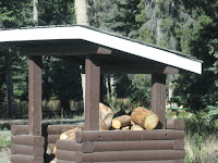
 At the campground, some workmen were taking away all the logs - I guess fire hazartd, although in order to burn one ofthese logs, you need Paul Bunyon to split it for you - They're huge!
The lower end of the lake is a dry bed and the highway has been built across it. At the other end of the elevated road is a viewing area for Dall sheep, up on the high hills. It is equipped with powerful telescopes. We didn’t stop.
Our campsite at Congdon creek was right on the lake. It is such a huge lake! We could see the mountains we had just come through in the distance. I caught sight of something bright in the water, and thought it was a bottle that needed picking up. Instead, it was a “growler”, with whiskey in it and three bottles of beer that someone had left cooling in the lake.


No comments:
Post a Comment